PhD Research:
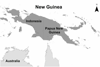
My research was located in Papua New Guinea. There were two components to my research, the first was to understand the relationship between subsistence livelihoods and land change in a coastal village. The second was to create the first comprehensive and objective map of terrestrial plants for New Guinea using a ecological niche model, MaxEnt. I defended my dissertation in October, 2016 and below are more details about each chapter. Full text is available upon request.
Comparing and combining Landsat satellite imagery and participatory data to assess land-use and land-cover changes in a coastal village in Papua New Guinea Human Ecology 45 (2), 251-264
Abstract: IIn regions lacking socio-economic data, pairing satellite imagery with participatory information is essential for accurate land-use/cover (LULC) change assessments. At the village scale in Papua New Guinea we compare swidden LULC classifications using remote sensing analyses alone and analyses that combine participatory information and remotely sensed data. These participatory remote sensing (PRS) methods include participatory land-use mapping, household surveys, and validation of image analysis in combination with remotely sensed data. The classifications of the swidden area made using only remote sensing analysis show swidden areas are, on average, two and a half times larger than land managers reported for 1999 and 2011. Classifications made using only remote sensing analysis are homogeneous and lack discrimination among swidden plots, fallow land, and non-swidden vegetation. The information derived from PRS methods allows us to amend the remote sensing analysis and as a result swidden areas are more similar to actual swidden area found when ground-truthing. We conclude that PRS methods are needed to understand swidden system LULC complexities.
Modeling Hotspots of Plant Diversity in New Guinea Tropical Ecology 58 (3), 623-640
Abstract: New Guinea is widely known for rich biodiversity. This study provides a foundation for understanding vascular and non-vascular plant distributions at the genus taxonomic level. Analyses objectively and quantitatively showed collection density and biases at 50 km spatial resolution and predict genus richness at 1 km spatial resolution. To model the distribution of 1354 genera presence-only data and the MaxEnt niche model were used. Results showed many cells with fewer than 5 unique genera whereas other cells had upwards of 600 unique genera. Model performance achieved a mean test AUC score of 0.7. The most influential environmental variables were elevation, slope, and temperature annual range. Predicted genus richness increased from south to north across the island and west to east along the central mountain range. Models predicted higher richness in topographically complex regions at higher elevations. Comparatively, lower elevations with homogenous topography had larger tracts of high genus richness. Modeling genus level data supplied baseline information about plant distributions, yet some genera are more speciose than others, so the full scope of richness or endemism may not be captured. Results can be used to prioritize sampling needs, support conservation strategies, compare genus diversity to other regions, and discuss biogeography principles.
Assessing swidden land-use in a coastal village in Papua New Guinea
Abstract: The inclusion of participatory data is one way to minimize remote sensing classification challenges and provide essential information to link observed patterns and trends from local, ground-level activities to remotely sensed data. At the village scale, we pair 40 Landsat scenes between 1972 and 2015 with participatory data to assess temporal swidden-fallow agricultural trends. The swidden-fallow area expands and contracts over time and land-managers describe that swidden-fallow subsistence strategies and decisions are influenced by environmental impacts and extreme weather events associated with climate change. These results differ from those found at wider geographical extents, which fail to incorporate reasons other than population growth to explain swidden-fallow land changes. The inclusion of participatory information is vital, as it explains general swidden-fallow trends, land-use during imagery gaps, scenes with swidden-fallow area anomalies, and resource use changes that would otherwise be excluded from land-cover analyses. Understanding changes in land-use using participatory data are a key component to identifying how and why land-use changes occur in areas where swidden-fallow systems are found. (in prep)
